
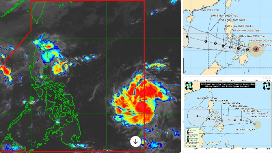
MANILA, Philippines – Typhoon Tino (international name: Kalmaegi) continued to intensify on Monday, November 3, as it approached the eastern coast of the Philippines, prompting widespread evacuations and storm warnings across the Visayas and parts of Mindanao.
As of 11 a.m., the center of Tino was estimated at 285 kilometers east-southeast of Guiuan, Eastern Samar, moving west-northwest at 15 to 30 kilometers per hour. The typhoon packs maximum sustained winds of 150 to 165 km/h near the center and gustiness reaching 200 km/h, according to the Philippine Atmospheric, Geophysical and Astronomical Services Administration (PAGASA).
Signal warnings up, landfall expected
Signal No. 3 has been raised over parts of Eastern Samar, Southern Leyte, and Dinagat Islands, where residents have been told to prepare for destructive winds and intense rainfall. Signal Nos. 1 and 2 are in effect over several other provinces in Eastern and Central Visayas, and parts of Mindanao.
PAGASA warned that Tino could make its first landfall late Monday night or early Tuesday (November 3–4) over southern portions of Eastern Samar or Leyte before crossing the Visayas region and heading toward northern Palawan. The storm may re-emerge over the West Philippine Sea by mid-week.
Threat of floods, landslides, and storm surges
Disaster officials cautioned that Tino’s rains could trigger flash floods and landslides in upland areas, while coastal communities in Eastern Samar, Masbate, Romblon, and northern Palawan may experience storm surges up to three meters.
PAGASA said sea travel remains risky to extremely dangerous due to rough to very rough seas reaching up to nine meters.
Local governments in the Visayas have begun evacuating residents from flood- and landslide-prone areas, while the Philippine Coast Guard has suspended sea travel across affected regions.
Intensification possible
Meteorologists said Tino is still over warm waters east of the Visayas, creating conditions favorable for rapid intensification. They do not rule out the possibility of it reaching super typhoon status in the next 24 hours.
Government response
The National Disaster Risk Reduction and Management Council (NDRRMC) urged local officials to activate contingency plans, pre-position relief goods, and maintain coordination with PAGASA for real-time updates.
Authorities advised the public to stay indoors, monitor official bulletins, and heed evacuation orders from local governments.
“We urge everyone in the path of Typhoon Tino to take this seriously,” the NDRRMC said in a statement. “Prepare now, stay safe, and avoid unnecessary travel.”
Tino is the country’s 19th tropical cyclone of 2025 and the second for November. PAGASA expects one to two more cyclones to enter the Philippine Area of Responsibility before the year ends.


