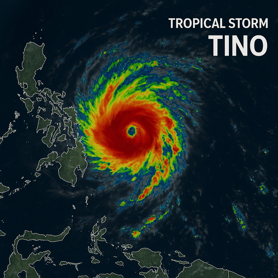
MANILA, Philippines – The Philippine Atmospheric, Geophysical and Astronomical Services Administration (PAGASA) raised Tropical Cyclone Wind Signal (TCWS) No. 3 over parts of the Visayas and Mindanao on Sunday as a tropical cyclone continues to move closer to land, bringing strong winds of up to 117 km/h and heavy rains that may trigger floods and landslides.
Under Signal No. 3, winds between 89 to 117 kilometers per hour are expected within 18 hours, strong enough to cause damage to light structures and uproot small trees.
Signal No. 3 areas
PAGASA said the following areas are now under TCWS No. 3:
-
Southern Eastern Samar: Guiuan, Mercedes, Lawaan, Balangiga, Giporlos, Quinapondan, Salcedo
-
Southern Samar: Marabut
-
Central and southern Leyte: Tanauan, Palo, Tabontabon, Isabel, Merida, Palompon, Ormoc City, Dagami, Pastrana, Burauen, Albuera, MacArthur, La Paz, Mayorga, Dulag, Julita, Tolosa, Abuyog, Javier, Baybay City, Mahaplag, Inopacan, Hilongos, Hindang, Bato, Matalom
-
Southern Leyte, Camotes Islands, and eastern Bohol: Pres. Carlos P. Garcia, Bien Unido, Ubay, Trinidad, Talibon, San Miguel, Mabini
-
Dinagat Islands, northern Surigao del Norte (including Surigao City, San Francisco, Tagana-an, Placer, Sison) and the islands of Siargao and Bucas Grande
Signal No. 2 areas
Meanwhile, TCWS No. 2 is in effect in parts of Masbate, Samar, Leyte, Biliran, Bohol, Cebu, Negros Island, Guimaras, Capiz, Iloilo, Agusan del Norte, Surigao del Norte and Surigao del Sur, and Camiguin.
Winds of 62 to 88 km/h may be experienced within 24 hours, possibly causing moderate to significant damage to light structures.
Signal No. 1 areas
Areas under TCWS No. 1 include Albay, Sorsogon, Quezon, Marinduque, Romblon, Mindoro, Palawan, Northern Samar, Siquijor, parts of Negros Island, Panay, and portions of Northern Mindanao and the northern portion of Zamboanga del Norte (Dapitan City, Sibutad, Rizal, Dipolog City).
These areas may experience winds of 39 to 61 km/h within 36 hours, potentially damaging weak structures and vegetation.
PAGASA warning
PAGASA warned residents in affected areas to brace for intense rainfall, strong winds, and rough coastal waters, particularly over Eastern Visayas and the northern Caraga region.
Fisherfolk and small sea vessels were advised to avoid venturing out to sea due to dangerous sea conditions.
The weather bureau said the tropical cyclone is expected to make landfall over Eastern Visayas or northern Mindanao in the next 24 to 36 hours before crossing the Visayas region.
Authorities have been placed on alert for possible flooding, storm surges, and landslides, particularly in low-lying and mountainous areas.
Local disaster response teams have started preemptive evacuations in coastal and high-risk communities as the storm continues to intensify.