ZAMBOANGA SIBUGAY — While Tropical Storm Tino (international name: Kalmaegi) barrels toward the Visayas with intensifying winds and torrential rains, the Zamboanga Peninsula — including Ipil and nearby towns — will experience cloudy skies, scattered rain showers, and isolated thunderstorms, the Philippine Atmospheric, Geophysical and Astronomical Services Administration (PAGASA) said Monday.
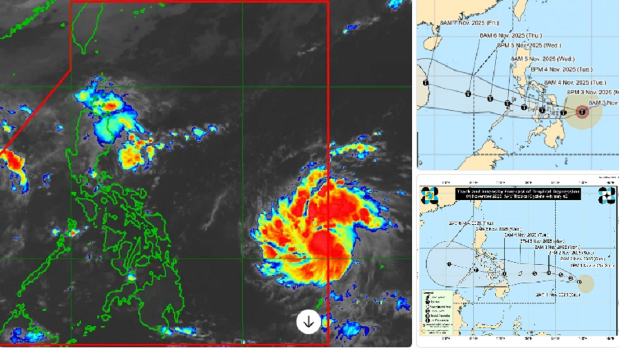
As of 8 a.m., PAGASA located Tino’s center about 360 kilometers east of Guiuan, Eastern Samar, packing maximum sustained winds of 110 kilometers per hour (km/h) and gusts of up to 135 km/h. The state weather bureau expects the storm to strengthen into a typhoon within 24 hours moving west-southwest at around 25 km/h.
Tropical Storm Signal
PAGASA raised Tropical Cyclone Wind Signals over parts of Eastern Visayas and Mindanao, including Eastern Samar, Leyte, Biliran, Dinagat Islands, and Surigao del Norte, but Zamboanga Sibugay and other areas in the western Mindanao region remained outside the warning zones.
Despite its distance from the storm’s core, the weather bureau warned that Tino’s broad circulation and the Northeast Monsoon (Amihan) would bring intermittent rains and thunderstorms to parts of Mindanao.
“For Ipil and nearby towns like Titay, Tungawan, and Kabasalan, expect cloudy skies with scattered rain showers and thunderstorms,” PAGASA said in its regional forecast. “Winds will be light to moderate, and seas will be slight to moderate.”
Local forecasters said thunderstorms are likely in the late afternoon and evening, with daytime temperatures reaching 31°C and cooling to 24°C overnight.
Advise to Residents: Stay Alert
Authorities advised residents living in low-lying or flood-prone areas to remain alert for possible flash floods or landslides, especially as the ground has become saturated from previous rains.
Though Ipil lies far from Tino’s projected path, the provincial disaster management office has urged coastal communities to exercise caution, particularly small fishing vessels, due to rough sea conditions in nearby eastern seaboards.
Tino is forecast to make landfall over the southern portion of Eastern Samar or Leyte by early Tuesday. It will cross the Visayas before exiting toward the West Philippine Sea on Wednesday.
PAGASA will issue its next weather bulletin at 11 a.m.